
THE DIVERSITY OF THE ISLAND
If we see the island of Bastimentos on a map and follow its geography we can see several regions, each of which has its own attractions for tourism. Starting from the north of the island, that we visited on another page of this site, we follow the map, clockwise direction.
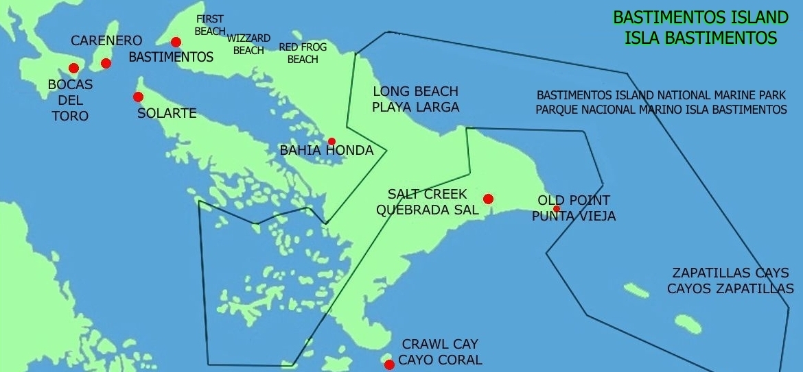
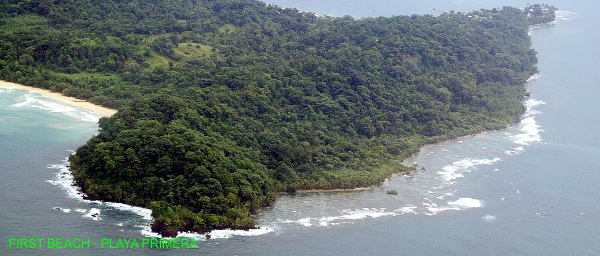
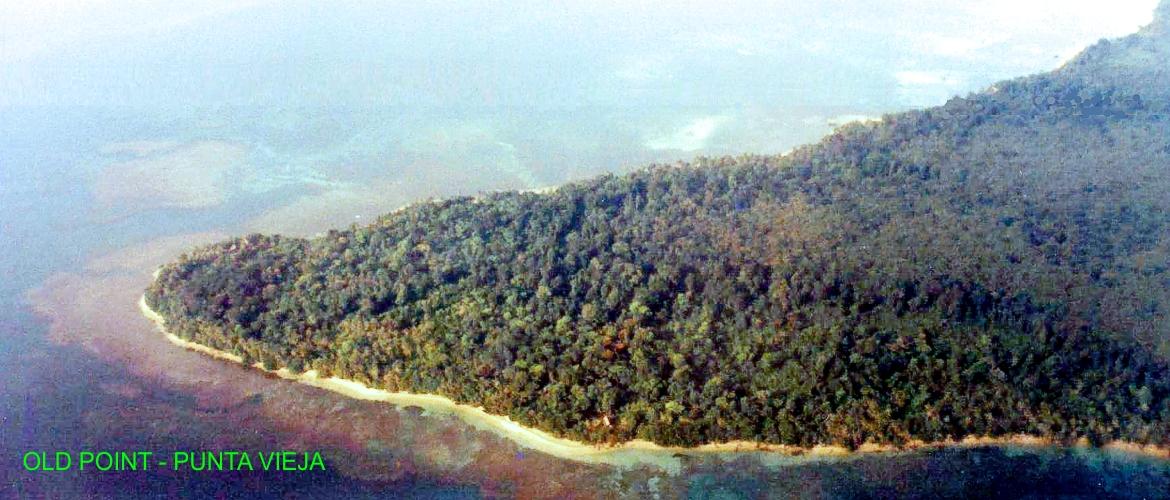
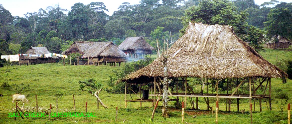
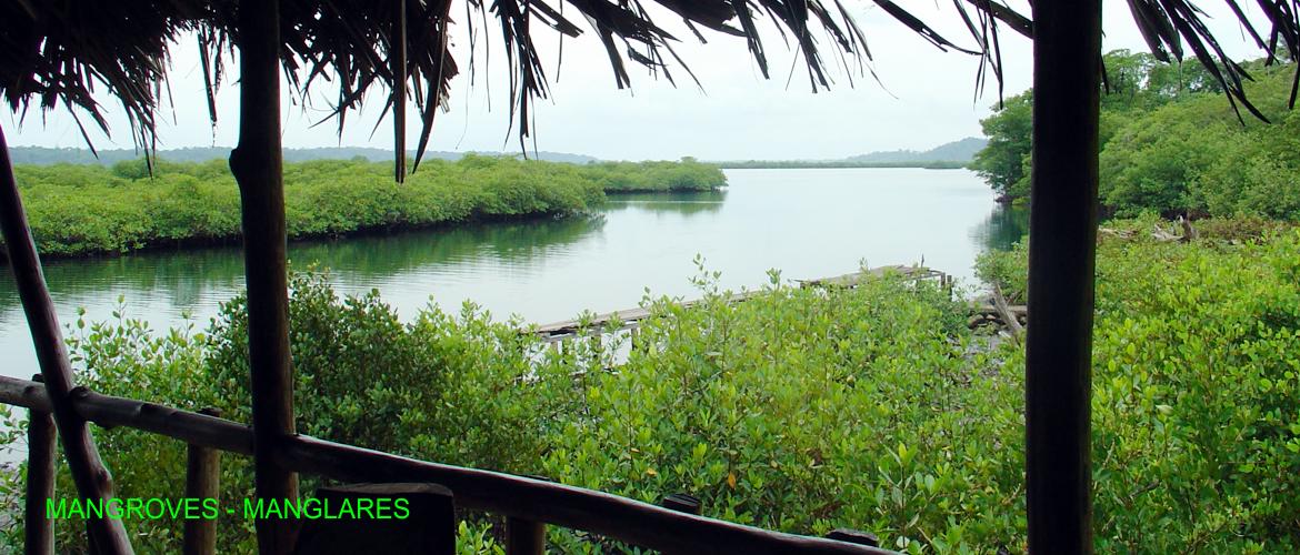
This is the region of the main beaches of the island: First, Wizard, Red Frog and Polo. Continuing along the coast, to the east is Long Beach, part of the Bastimentos Island National Marine Park. Then, at the eastern end of the island, we find the area of Old Point and the Ngäbe indian community of Salt Creek, an area that stretches along the east coast, with many coral reefs, some small beaches, aboundant mangroves and, inside, rain forests and wetlands.
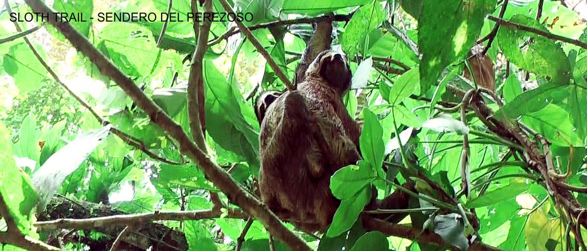
Now, we arrive at Cayo Coral, one of the favorite places for tourists, where you can find several restaurants located on the sea, with coral reefs easy to snorkel, at short distance from them. Continuing along the south coast of the island we arrive, after passing the strait which separates it from Solarte, the Ngäbe community of Bahia Honda, with its typical restaurant and one of the best tours in the region: the Trail of the Sloth.
A little further on, always towards Bastimentos Town, we arrived at the Red Frog Trail, short path through the forest of the island to reach one of the places already mentioned: the Red Frog Beach. With this we close the circuit around Bastimentos Island.
